
Indian Surveying & Mapping Solution: Pioneering Precision and Innovation
A new era of geospatial intelligence has been ushered in by India's technological advancements in aerial and ground-based mapping. Indian Surveying & Mapping Solutions is currently changing the way that various industries gather, examine, and apply spatial data. Indian advancements in surveying and mapping are helping organizations make quicker, more informed, and more precise decisions in a variety of fields, including mining, infrastructure development, agriculture, and urban planning.
Indian Surveying & Mapping Solutions is not only fulfilling international standards but also establishing new ones in terms of accuracy, efficiency, and accessibility through the integration of drones, LiDAR, GIS, and AI-powered analytics.
The Evolution of Surveying and Mapping in India
Over the past few decades, India's mapping and surveying sector has seen significant change. Land mapping and surveying were labor-intensive, manual procedures that were prone to human error in the past. But this landscape has changed as a result of technological advancements.
The advent of digital geospatial systems, satellite imagery, and drone-based aerial mapping has completely changed how experts collect and analyze data. Indian businesses and research institutions are currently creating in-house surveying solutions that are suited to the nation's various topographies, climates, and legal systems.
This expansion has been made possible by government programs like Digital India and the National Geospatial Policy 2022, which have given Indian businesses the freedom to develop in the domains of aerial surveying, GIS mapping, and remote sensing.
What Makes Indian Surveying & Mapping Solutions Unique?
Indian Surveying & Mapping Solutions stands out for its accuracy, affordability, and versatility. These solutions, which combine cutting-edge technology with extensive local knowledge, are designed to function throughout India's enormous and diverse terrain, from coastal regions and deserts to mountains and urban settings.
Indian solutions are created with consideration for regional issues, such as high humidity, rough terrain, and a variety of data requirements, in contrast to imported systems that frequently need customization. They are perfect for both public and private organizations since they easily integrate with regional data systems and adhere to national surveying laws.
Furthermore, real-time data processing is incorporated into a lot of Indian surveying solutions, allowing for immediate visualization and analysis for speedier decision-making. This is especially useful for environmental monitoring, smart city initiatives, and infrastructure development.
Technologies Driving Indian Surveying & Mapping Solutions
Indian Surveying & Mapping Solutions' strength is rooted in their cutting-edge technological base. To guarantee the highest levels of accuracy, modern solutions integrate a number of data processing and acquisition tools.
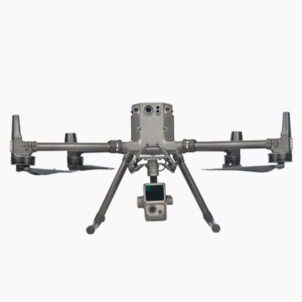
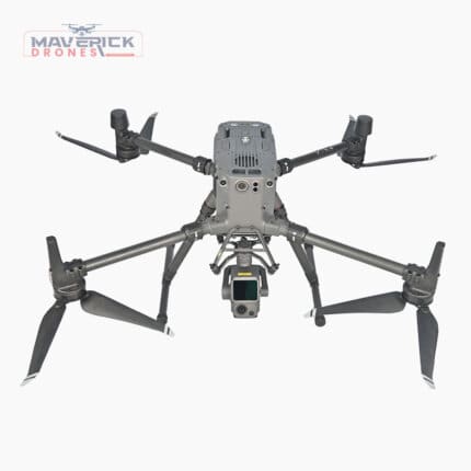
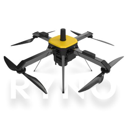
Drone-Based Aerial Mapping
Modern Indian mapping relies heavily on drones that are outfitted with LiDAR sensors, high-resolution cameras, and photogrammetry tools. In a fraction of the time needed by conventional methods, these UAVs can survey large areas and create detailed 2D and 3D maps for use in land management, agriculture, and construction.
LiDAR and Photogrammetry
Two essential technologies in advanced surveying are photogrammetry and Light Detection and Ranging (LiDAR). Compact, high-precision LiDAR systems are now available from Indian companies that can be mounted on cars or drones to create centimeter-accurate topographic maps.
GIS and Spatial Analytics
Organizations can meaningfully analyze and visualize spatial data with the help of Geographic Information Systems (GIS). For infrastructure, forestry, and urban planning projects, Indian surveying solutions frequently include integrated GIS platforms that let users overlay multiple data layers and make data-driven decisions.
Artificial Intelligence and Machine Learning
The Indian surveying and mapping sector is undergoing significant change as a result of AI and ML. These days, algorithms automate processes like change detection, terrain classification, and feature recognition. This automation increases data efficiency and accuracy while lowering the amount of manual labor.
Applications of Indian Surveying & Mapping Solutions
Indian Surveying & Mapping Solutions has numerous uses in a variety of government and commercial domains.
Urban Planning and Smart Cities
Because they offer precise information on land use, infrastructure, and utilities, surveying and mapping are essential to smart city initiatives. Indian surveying systems assist city planners in making well-informed choices regarding transportation, zoning, and development.
Agriculture and Forestry
Precision farming in agriculture is made possible by drones and mapping software, which aid farmers in assessing crop conditions, irrigation schedules, and soil health. Mapping tools are used by forestry departments to monitor deforestation, manage biodiversity, and prevent fires.
Infrastructure and Construction
Indian Surveying & Mapping Solutions offers topographical information and 3D site models to construction companies, which are necessary for planning, excavation, and progress monitoring. Errors and project delays are decreased as a result.
Mining and Resource Management
Drone-based mapping is used by mining companies to monitor stockpiles, estimate ore volumes, and guarantee environmental compliance. Surveying instruments created in India are now an essential component of site safety and sustainable resource management.
Disaster Management and Environmental Monitoring
During natural disasters, precise mapping is essential. Real-time terrain analysis made possible by Indian surveying solutions aids emergency teams in determining damage, creating evacuation routes, and effectively coordinating relief efforts.
Advantages of Indian Surveying & Mapping Solutions
There are numerous important benefits to using an Indian surveying and mapping solution.
First and foremost, cost effectiveness is noteworthy. When compared to imported alternatives, Indian manufacturers offer top-notch technologies at a fraction of the cost. Because of their low cost, advanced surveying tools are available to government agencies, SMEs, and startups alike.
Second, local adaptability guarantees that Indian systems are adapted to the infrastructure and environmental conditions of India. They are made to resist heat, moisture, and dust—all of which are frequent problems for field operations in India.
Thirdly, robust support and service networks are provided by Indian solutions. Due to the technology's domestic development, users experience less downtime because upgrades, spare parts, and technical support are easily accessible.
Last but not least, Indian innovations in mapping and surveying promote data sovereignty, which is essential for privacy, security, and defense since it keeps sensitive geospatial data inside national borders.
Government Support for the Surveying and Mapping Industry
The Indian government has taken the initiative to support the mapping and surveying community. Private organizations are now able to gather and use geospatial data for business purposes thanks to the liberalization of drone and mapping regulations.
Initiatives such as the Geospatial Data Guidelines 2021, the National Drone Policy, and the Survey of India's modernization projects have created a wealth of chances for private involvement and innovation. A thriving ecosystem of drone manufacturers, GIS developers, and mapping service providers has emerged as a result of these reforms, positioning India as a global center for geospatial technology.
The Future of Indian Surveying & Mapping Solutions
Indian Surveying & Mapping Solutions has a very bright future. Data collection will become more accurate and faster as automation, IoT, and AI technologies develop. Even in remote areas, real-time data transmission made possible by 5G integration will support live mapping and quick analytics.
It is anticipated that emerging trends like digital twins, which create digital replicas of real-world assets for monitoring and simulation, will completely transform infrastructure management and planning. Indian businesses are already attempting to incorporate these technologies into their platforms for conducting surveys.
Furthermore, government, academic, and private sector partnerships are speeding up innovation. Indian Surveying & Mapping Solutions will be essential in promoting sustainable growth and technological independence as India makes more investments in digital infrastructure.
Why Choose Indian Surveying & Mapping Solutions?
Selecting an Indian surveying and mapping solution entails making an investment in performance, dependability, and innovation. These systems guarantee accurate, useful insights under Indian conditions by fusing cutting-edge engineering with local knowledge.
Indian mapping technologies provide the adaptability and scalability required for a variety of operations, including construction, agriculture, defense, and environmental management. They enable businesses to work more efficiently, make decisions more quickly, and maximize resources—all while fostering the development of domestic technology.
Conclusion
Leading the nation's digital transformation are Indian Surveying & Mapping Solutions. These solutions, which combine drone integration, AI-powered analytics, and top-notch technology, are completely changing how India maps, measures, and manages its resources.
The need for accurate, dependable, and locally produced surveying solutions will only increase as industries shift toward automation and data-driven decision-making. A smarter, more connected, and independent future is being ushered in by Indian Surveying & Mapping Solutions, which is supported by innovation, government assistance, and a dedication to quality.


