

SENSYS MagDrone R1 Magnetometer
In stock
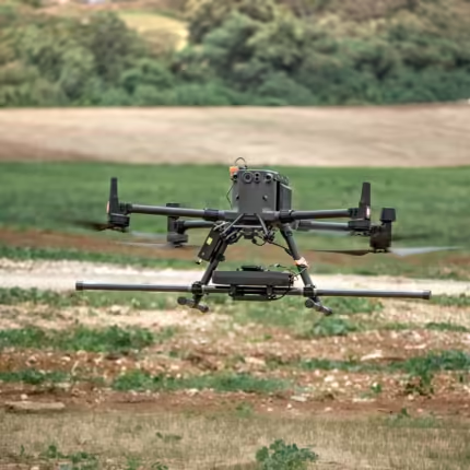
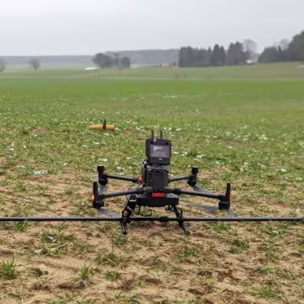
SENSYS MagDrone R3 Magnetometer
In stock

SENSYS MagDrone R4 Magnetometer
In stock
Drone Surveying: Transforming Modern Mapping and Data Collection
The use of drone surveying has completely changed how industries handle data collection, mapping, and inspection. Conventional land surveying techniques frequently call for large workforces, hefty machinery, and substantial time commitments. Drones, on the other hand, offer a quicker, safer, and more affordable option, making them essential equipment for sectors like infrastructure, mining, construction, and agriculture. Drone surveying has emerged as one of the most dependable options in contemporary geospatial practices due to its capacity to produce precise 2D and 3D models and record high-resolution aerial data.
What Is Drone Surveying?
Drone surveying is the process of gathering data from above using unmanned aerial vehicles fitted with sophisticated cameras, LiDAR sensors, or photogrammetry software. Following processing, this data is turned into measurements, maps, and models that aid industries in assessing assets, structures, and terrain. Drone surveying produces accurate results in a fraction of the time required for traditional surveying techniques, which can be labor-intensive and time-consuming.
Drones collect geospatial data and detailed images by flying over specific areas. This data is processed by sophisticated drone software to produce volumetric calculations, elevation models, topographic maps, and incredibly precise site analyses. Because of this, drone surveying is not only quicker than traditional techniques but also more flexible.
The Importance of Drone Surveying in Modern Industries
Drone surveying is important because it can yield precise and useful data. Drones efficiently provide the information that industries need to make decisions. Drone surveying in construction guarantees precise site planning, progress tracking, and quality assurance. Drones in agriculture aid in soil analysis, crop health monitoring, and irrigation practice optimization.
Drone surveying is used by governments and municipalities for disaster management, infrastructure inspection, and urban planning, and by mining companies to manage resources and determine stockpile volumes. The ability to capture real-time data reduces risks, lowers operational costs, and improves overall productivity.
How Drone Surveying Works?
Mission planning is the first step in the drone surveying process. The drone's flight paths are programmed by operators to cover the site in a methodical manner after they have defined the area of interest. The drone's cameras and sensors take pictures and gather geospatial data from various perspectives while in flight. Maps, models, and comprehensive reports are then produced by processing this raw data with specialized software.
Photogrammetry, which stitches together overlapping images to produce precise 3D models, is frequently used in drone surveying. LiDAR technology is sometimes used to create extremely detailed elevation models by penetrating vegetation. An accurate and trustworthy depiction of the surveyed area is the end result, which can be utilized for planning, analysis, and measurement.
Applications of Drone Surveying
Drone surveying has applications in many different industries. Drones in construction help with site preparation, land assessment, and project progress tracking. By offering real-time insights, drone surveying guarantees that work remains within budget and on schedule.
Drone surveying in agriculture allows farmers to assess crop conditions, manage resources, and boost yields. By eliminating the need for manual surveying in dangerous areas, drones in mining help monitor pits, determine stockpile volumes, and guarantee worker safety.
Government organizations and urban planners use drone surveying for land-use planning, infrastructure inspections, and city development projects. Environmental researchers use drones to measure the effects of climate change, track deforestation, and observe wildlife habitats. Drone surveying is a vital tool in many different fields because of its adaptability.
Advantages of Drone Surveying
The numerous benefits that drone surveying provides over conventional surveying techniques are what are driving its growth. One of the biggest advantages is speed, since drones can survey vast areas in a few hours as opposed to days or weeks. Another benefit is accuracy; drones can record high-resolution data that satisfies the needs of sectors that need exact measurements.
Cost-effectiveness holds equal significance. Drone surveying is a more affordable option because it eliminates the need for costly equipment and sizable surveyor teams. Drones can reach challenging or hazardous areas without endangering human life, which significantly improves safety. Furthermore, due to their adaptability, drones can be utilized in a wide range of industries, each with its own set of challenges.
Challenges in Drone Surveying
Drone surveying has certain drawbacks despite its many benefits. Weather conditions like intense rain, strong winds, or poor visibility can hamper flights and decrease data quality. Drone operators must obtain permits and follow strict guidelines due to regulations that differ between nations and regions.
Data processing presents another difficulty. Drones can swiftly gather vast amounts of data, but it takes specialized knowledge and sophisticated software to turn this into useful information. Flight durations can also be limited by battery limitations, though this problem is being gradually resolved by technological advancements. LiDAR is one of the additional technologies that may be needed to ensure accuracy in heavily forested or obstructed areas.
The Role of Drone Software in Surveying
The software used to process the data gathered from drone surveys is crucial to its success. Operators can plan missions, control flight paths, and convert aerial photos into precise geospatial outputs with the help of sophisticated drone software. LiDAR processing software produces extremely accurate terrain maps, while photogrammetry software creates detailed 3D models by piecing together thousands of images.
Teams can collaborate in real time and share survey results instantly thanks to cloud-based platforms. Drone survey data can be easily integrated into bigger planning and development projects thanks to integration with geographic information systems. The capabilities of drone surveying are constantly being expanded by software innovation.
The Future of Drone Surveying
Drone surveying has a promising future thanks to developments in artificial intelligence, software, and hardware. Drones with AI will be able to analyze data in real time, finding patterns and providing insights without requiring human processing. Machine learning will enhance object recognition, making it simpler to recognize vegetation, structures, and other features.
Advancements in battery technology will prolong flight times, allowing drones to cover more ground uninterrupted. By integrating with cloud platforms, teams will be able to collaborate more effectively and access survey data from any location. Drone surveying will become an even more common practice across industries as regulations change to allow drone use.
Why Drone Surveying Is the Future of Mapping?
The increasing use of drone surveying is indicative of a trend toward quicker, more intelligent, and more effective mapping and data collection techniques. It is a vital tool for industries looking to gain a competitive edge because of its capacity to produce accurate results faster and at a lower cost. Drone surveying offers the information required for intelligent decision-making in fields like mining, construction, agriculture, and environmental monitoring.
Drones' use in surveying will grow as technology advances, becoming a crucial component of resource planning, development, and management across industries. Drone surveying is a game-changing technology that is influencing mapping and geospatial analysis in the future, not just a passing fad.
Conclusion
The way that industries approach mapping and data collection has been completely transformed by drone surveying. It provides solutions that conventional surveying techniques cannot match due to its speed, accuracy, affordability, and adaptability. Drones have demonstrated their worth in a variety of fields, from enhancing safety on construction sites to facilitating precision farming in agriculture.
Drone surveying will become more commonplace as technology develops and legal frameworks become more accommodating. Investing in drone surveying is not only sensible but also necessary for companies and organizations that want to embrace innovation in order to stay ahead in a data-driven world.


